Our first week in Arizona was a bit of a whirlwind. When you say that you’ll be staying somewhere for a month, that seems like a really long time. Before we actually arrived we felt like we were going to have all the time in the world to adventure and relax, but as soon as we got there, we felt the pressure of the calendar. We only had 31 days in Arizona! That’s 31 days to unpack and get settled in, get to know the area, research, document, and prioritize all the trails within a 150mi radius of our airbnb, hike at least one trail per day, coordinate visits with family and friends, pack up, and hit the road again. And we’ll be working the whole time! We realized right away that one month was not going to be enough for us to live our life like we planned to in that part of the country. There was just so much to do! Maybe we could have done it all in 6mo if we were really disciplined. But as it was, something had to give, and usually that something was our downtime and recovery days. Even though we were coming off of two weeks of traveling, and more excitement than any of us had had in our short little lives, we couldn’t take a break. We had to dive right in to this part of the adventure so that we didn’t waste even one day.
Life
We arrived to our Airbnb mid-afternoon on a Monday that we had taken off work, and our first act was to finally (blessedly!) unpack the car. We had been doing this awkward dance with all of our belongings where we would kind of half-unpack the car at every stop. Some things came out every time (small duffle bags with ~4 days worth of clothes, toiletries, dog supplies), but other things only had to come out on a situational (dog kennel, hiking gear) or environmental (will this item freeze/heat up if left in the car?) basis. Some things we didn’t need for short term travel, but thought we would need for a longer stay, and those tended to stay in the car. A major learning from this trip was to think about all of these factors before packing up and to group like items together. We were primarily concerned with fitting everything into the car when we left Milwaukee, so there were seemingly random items scattered throughout our luggage. When we partially unpacked in Omaha after our first night of driving, we thought we got everything that could freeze out of the car, but there was a random bottle of sunscreen in our game bag for some reason. Luckily nothing exploded or was ruined, but we were definitely learning and improving our process as we went. Bonus: as we got more organized, the car actually seemed to have more space. It could have been because Dog was working his way through the 15lb bag of dog food, but I choose to think it was because we were getting better at packing. All that to say though, that we were absolutely ecstatic to empty the car.
Once we put everything away, our next order of business was to stock the fridge. We had been on the road for two weeks, so we hadn’t had very much in the way of homemade meals. Obviously, M and I love to treat ourselves, but we didn’t plan on eating out for many of our meals while we were in Arizona. Our initial plan was to make lunch our big meal every day, and then prepare a nutritious dinner ahead of time that we could eat while on our hikes in the evenings. That didn’t work out even one time because a.) we didn’t have the time to prep and cook two separate meals over our lunch hour, and b.) we never wanted to stop during our hikes to sit and eat dinner because that would waste our precious daylight, and c.) the hikes we were doing during the week were rarely long enough to warrant a snack stop, let alone a meal break. But other than that, we had a pretty good plan for meals. Before we left, we rounded up a handful of recipes that used similar ingredients. We were only going to be there for a month, so we didn’t want to buy a huge variety or huge quantity of things that we couldn’t use up. To that end, we actually brought with us a pretty impressive assortment of spices from our own spice cabinet at home. They were only things that were actually in the recipes we planned to use, but definitely things we didn’t want to buy in Arizona only to leave there, or bring back home and have double of. I also printed off (and laminated because I am a bit much even for myself sometimes) tiny little ingredient lists for the recipes we identified earlier. We put these on a key ring and left them in the car so that we would have them on hand at the grocery store after a hike, and never have to look up recipes in the moment, or worse, just wing it at the grocery store and hope you didn’t forget anything (because if you did, the closest grocery store was 20mi away, and it was going to be a whole to-do). Our first trip to the grocery store was a stressful one. We were not familiar with the store names, so we couldn’t pick out right away which one (Safeway) would be the best (Safeway) for us to stock up on all the essentials (Safeway). We chose Sprouts. We had done some shopping at Sprouts in Colorado and enjoyed ourselves. It’s a health food store, kind of like a less-bougie Whole Foods, so for the most part the brands are not household names, and the selection could best be described as “eclectic.” That was not what we needed after a long travel day and with a huge list of ingredients to stock otherwise totally empty cabinets and refrigerator. You’d be looking for something basic like iced coffee, and this store would offer you up something like dehydrated papaya crisps that you don’t even know how to compare to the thing on your list. It seemed like there was at least one ingredient from every recipe we could not find, the most critical being poblano peppers. We (naively, it seems) assumed that because we were in the American Southwest, we would be tripping over peppers. Basically all of our recipes included them. We had been on a poblano fast leading up to Arizona because we thought we were going to consume so many while we were there. But no poblanos at Sprouts. And when we went to Trader Joe’s later in the week? No poblanos at Trader Joe’s. That’s when we decided Safeway was our jam. But back at Sprouts our stress levels were steadily increasing, and both M and I were headed for full meltdowns in the middle of the Blend Your Own Peanut Butter aisle, so we just paid $250 for the weird labels of 75% of the food we needed and called it a night. From that point on, Sprouts became an epithet in our household.
Working from the Airbnb also became something of an unexpected challenge for us. Neither M nor I would have taken this trip if we didn’t have a very firm handle on our jobs and how to do them remotely. We had quite a nice rhythm back home, but of course, as soon as we crossed the first state line, something in the cosmos shifted and we both found ourselves absolutely buried in work. M was effectively working two jobs while training up a new team member, and I found myself hosting working sessions for teams I had only met (virtually) days before while also accounting for the unexpected multi-week absence of my main functional partner. It was chaotic to try and balance all the extra work and still draw a hard line around our personal time. If we had been at home, I think both of us would have been able to flex a bit more and log on earlier or stay working later to accommodate the barrage, but with the time change, I was already taking calls starting at 5AM. Even though it was hectic, I think the weeks we spent working from Arizona, and especially that first week, really helped crystallize the idea that we were “working to live” and not “living to work.” It was so liberating to be able to close the laptop and within 15min be totally out of cell service (something that never happens at home), and then see the next morning that the company hadn’t burned to the ground in our absence. And actually, we both received recognition or awards for the work that we did during this time. This trip prompted a huge shift in our mindsets and how we consider our work-life balance.
Trails
A disclaimer: sometimes it was really tough to put a name to the trails that we hiked. We used the trail-finding app AllTrails, but as my aunt says, “it has its limitations.” It wasn’t always accurate to what we saw on the hike, and our trackers always seemed to display a different mileage count than what was listed for each hike. Plus, with any given trail, there are off-shoots and connecting trails, lookouts, and points of interest, so you might design a route that touches four or five different named elements. What we came to learn pretty quickly is that Arizona is basically one vast spidery network of major and minor hiking trails. That made it tricky to plan hikes and stick to them, and it will make it difficult to convey exactly what we did and where we went each day, but we are going to try our best!
Boynton Canyon Trail
6.1 mi – 810 ft elevation gain – Out & Back
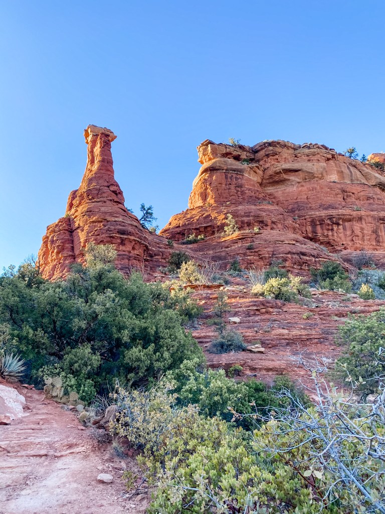
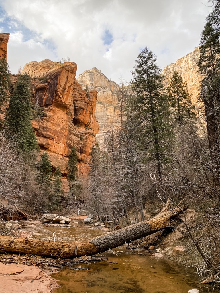
Our very first Arizona hike was at Boynton Canyon in Sedona. We didn’t yet have a bucket list of hikes we wanted to do, so I just cruised through AllTrails until I found one that had good ratings, wasn’t too challenging, and allowed dogs. M was really out of it that day, so I drove to the trailhead, which took us about an hour and was our first trip through Sedona and on the Red Rocks Scenic Byway. I was absolutely floored with the views just from driving in. When we arrived at the trailhead, there was a little pay station where we could buy a Red Rocks Day Pass for $5 or a weeklong pass for $15 (what they didn’t tell you at the station is that you could get a yearlong pass for $20). As we were contemplating whether on not we thought we would be back in this area three more times in the next week, a couple of women asked us if we wanted their day pass! Now we are not in the business of cheating parks out of money that is due to them, but we also don’t like to snub strangers when they make a generous offer. We accepted the pass and made a pact between the two of us that we would purchase a pass for this area before our trip ended. This was actually not the only time strangers gave us their day passes. Because we usually wouldn’t get to the trailhead until 4PM or so, most hikers were on their way out, and the rangers had already left for the day, so it was an easy way to get your Good Deed of the Day in. The trail itself had one climb right away with some cool views, and was our first experience with the red dirt Sedona is famous for. Like idiots, we wore our tennis shoes instead of our hiking boots, and very nearly destroyed them. On the trail, we passed two women who said they had just seen a cat run across up ahead of us. I didn’t think it was that interesting of an anecdote until they mentioned that it was a wild cat and was the size of Dog who is comfortably 60lbs. We didn’t see the big cat, but we did keep Dog on a tighter leash than usual. Boynton Canyon is also one of the best known vortices in Sedona. A vortex is a swirling concentration of the Earth’s energy that is supposed to aide in meditation, healing, and self-discovery. I saw it mentioned a few times on AllTrails, but it really came to life when we passed other hikers chanting and singing. We didn’t feel any particular energy at Boynton Canyon (or any of the other vortex sites we hiked), but we’re not here to yuck other people’s yum. We only made it about half way through this trail before it started to get dark and we decided to turn back. Since this was our first day trying to work and get out the door for a hike, we got a later start than we would have liked. Plus, M still wasn’t feeling that great. We wish we could have done the whole thing, but we learned a lot from this first attempt (and actually from our second hiking attempt the next day). At least until daylight savings time hit, we would need to be Ready To Go as soon as we logged off. That meant we needed a hike picked out, hiking bags packed, and snacks prepped and on hand when the clock struck 3:00PM. We also figured out that if we were going to drive an hour to the trailhead, the hike itself couldn’t be longer than 5mi or so. Anything further away from us would have to be shorter, anything closer could be a little longer. Overall, this hike was a fair introduction to Sedona, but not one we felt compelled to come back and complete. We gave it 3 stars out of 5.
The first climb was up into this saddle 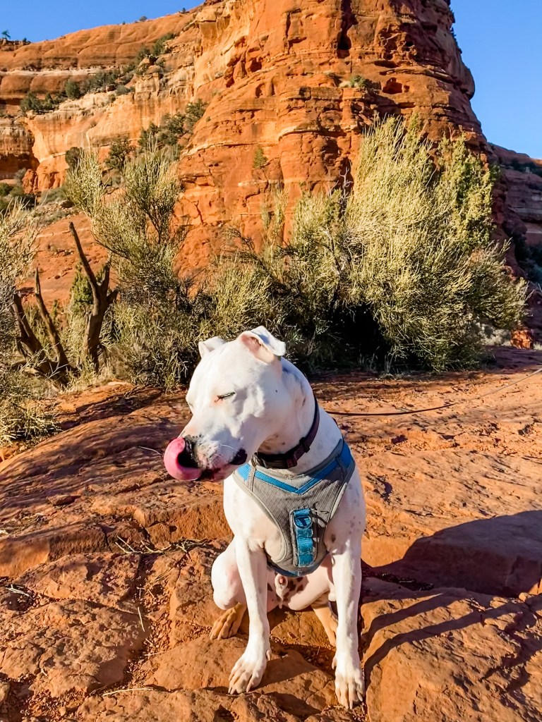
Dog looking stellar in the golden hour sun 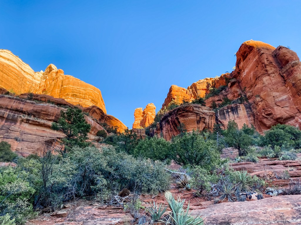
Hiking around sunset often left us with fiery red rocks, clear blue skies, and dramatic shadows 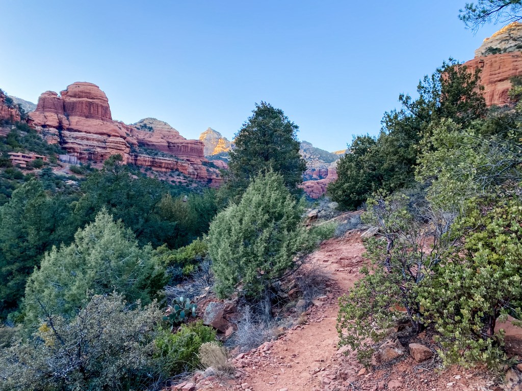
Out of the sun and trying to feel the vortex
West Fork Trail
6.8mi – 623ft elevation gain – Out & Back
We chose a hike at the other end of Sedona for our second day of exploring. For this one we would travel north to Flagstaff, pivot south, and drop down the face of Oak Creek Canyon. From our Airbnb, it was a shorter but more treacherous drive to this part of the city than the main portion. We arrived at West Fork right around 4PM and while we were searching for some way to pay at the ranger station (no automated booth this time!), ANOTHER couple graciously bestowed their day pass upon us. So for those of you keeping track at home, we were 2/2 for getting gifted day passes, and were feeling pretty sure that this was just how hiking worked – what a lovely pastime! West Fork Trail follows a small river that we suspect (but never confirmed) was Oak Creek, the canyon’s namesake, as it winds along steep canyon walls of red rock, and through shockingly dense pine forests. We saw in AllTrails that there were 13 river crossings on this trail, and we were excited at the potential to use our water shoes for the first time on the trip. We didn’t end up breaking them out on this trail because we didn’t have the time for a partial wardrobe change, but I am confident we will find a time and place to use them. Before you get to the river, you pass through the ruins of an old hunting cabin where there are a few plaques with information on them. This time our love of learning did come back to bite us because I think we spent a little too much time reading which made us have to cut our hike short. As we approached the actual trail, we came across a strange scene: there were corrals built up with 20 or so natural walking sticks propped up against them. M immediately grabbed a stick and wanted to use it during the hike, but I pointed out a.) they looked like they were there for a reason (“Yeah, for us to take!” M responded), b.) we are in the middle of a pandemic, so lets not touch the one thing in the forest 100 other grubby hands have touched, and c.) we have actual hiking poles – that we paid money for – in the car if he wanted to use one for the hike. Not willing to fight me about it in the middle of the wilderness, M left the sticks where they were and we forged on. When we got to the first river crossing another half mile down the trail, however, we had something of an epiphany. There was an older couple using two walking sticks a piece to stabilize themselves on the wobbly rocks and slick logs that VERY loosely constituted a crossing point. THAT’S what the sticks were for! Uh-oh. Both M and I scanned the forest for any felled branch or fallen stick that was halfway straight and tall enough to be useful. As it turns out, this is the point in the trail where everyone has a similar epiphany and performs a similar scan of the forest, so the pickins were slim. But the sun shines on J. I spotted a viable stick about a half second before M and dashed into the brush to claim my prize. Now, you, Reader, might be thinking that since we were only in this predicament because I had refused to let M take a stick from the corrals earlier on, perhaps I would let him use this stick until we could find a second. That would of course be the right thing to do. But unfortunately for M, the universal and unalienable truths of Finders Keepers, Losers Weepers, and The Girlfriend Is Always Right were at play here as well, and we were totally at their mercy ¯\_(ツ)_/¯ M did find an old gnarled branch after the third crossing that looked more like a question mark than a walking stick, but he insisted on using that so that he could be done searching. After that initial hiccup though, the trail was really cool! It’s always fun to hike along a natural water feature, and we had a grand time trying to guess where the “official” river crossings were (we definitely did more than 13), and watching Dog splash through the water. Because of the height and angle of the canyon walls, there were a lot of places on the canyon floor where there was still snow, but it was a perfect hiking temperature, and mostly out of the sun. When our fitness trackers showed that we were at 3.4mi, which was supposed to be the end of the trail, we weren’t at a natural stopping point, and the trail continued to stretch out ahead of us, so we had a decision to make: turn around and get back to the car, or press on and find the end of the trail. The sun hadn’t set yet, but it had dropped below the canyon walls. We knew that it would get darker faster down there by the river, and we were on unfamiliar terrain that would be dangerous in the dark. It was an easy, but frustrating decision to turn back – we were having so much fun on this trail, and really didn’t want to miss any of it! On the hike back, we did less playing and more hustling as dusk was settling in around us. Despite cutting the hike short, we were already having trouble picking out the path and seeing where we could safely put our feet on river crossings. The last 30min was in total darkness, and was actually really stressful. At any point we could have pulled out our headlamps, but we kept thinking we were at the last river crossing and that we wouldn’t need them after that. What we learned from this hike is something we probably should have learned from the classic cautionary tale of Hansel and Gretel as children, which is to mark your trail in a meaningful way (or in our case count your river crossings) and not stay out after dark. Luckily for us, we didn’t run into any cannibalistic forest witches though. We finally made it back to the trailhead, left our walking sticks amongst their comrades at the corral and got to the car. Despite a rocky start and finish, we absolutely adored this trail, gave it 5 out of 5 stars, and made immediate plans to return on a weekend and complete the whole route.
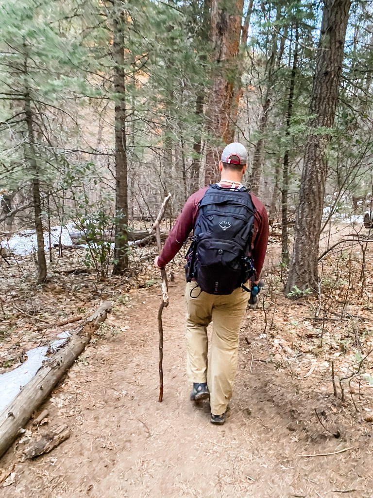
M and his wizard’s staff 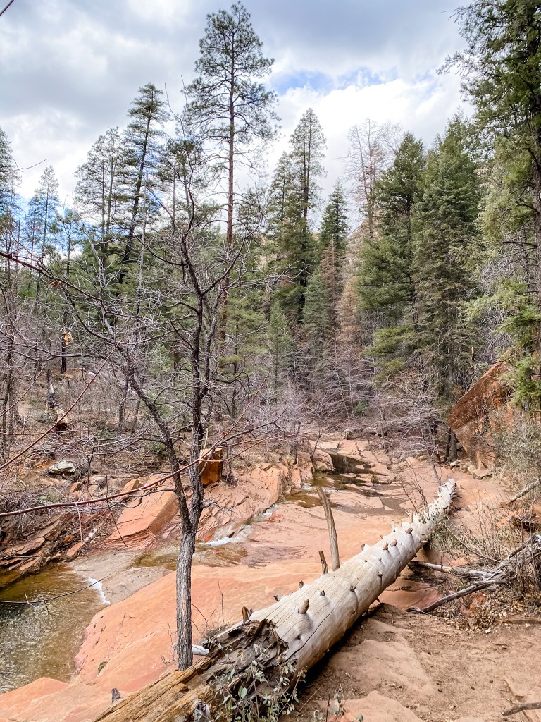
Pinewood Neighborhood Walk
3.25 mi – 265 ft elevation gain – Loop
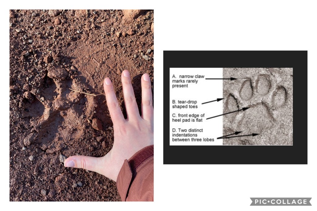
On Thursday it snowed! Well actually it snowed overnight on Wednesday, and up until about 10:30AM on Thursday. Then the melting began. We were kind of charmed by this first snow, and didn’t mind using it as an excuse to explore the neighborhood. Supposedly there were some hiking paths that we could walk to, but we never found anything that was really worth the time. We did find a trailhead that seemed promising, but the map was not clear and the whole area was a huge mud pit from all the precipitation earlier in the day. But muddy trails in other parts of the neighborhood DID allow me to play amateur tracker and try to determine what animals had crossed the trail before we had. Mostly, it was dogs. BUT there was one set of tracks that I think COULD have been a mountain lion. I took pictures of them while we were out and then did some sleuthing on the World Wide Web when we got home, but the results were inconclusive. Boo. After that we tooled around the rest of the neighborhood and tried to learn the street names and get oriented, which wound up being more of a task than we expected because for some reason the names of the streets changed at every intersection. A classic 4-way intersection in our neighborhood would have 4 street names instead of 2. It was like somebody had all of these great ideas for street names but not enough streets to use them all, so they changed the name of every road at every block. Madness.
Salida Gulch Trail
4.5 mi – 479 ft elevation gain – Loop
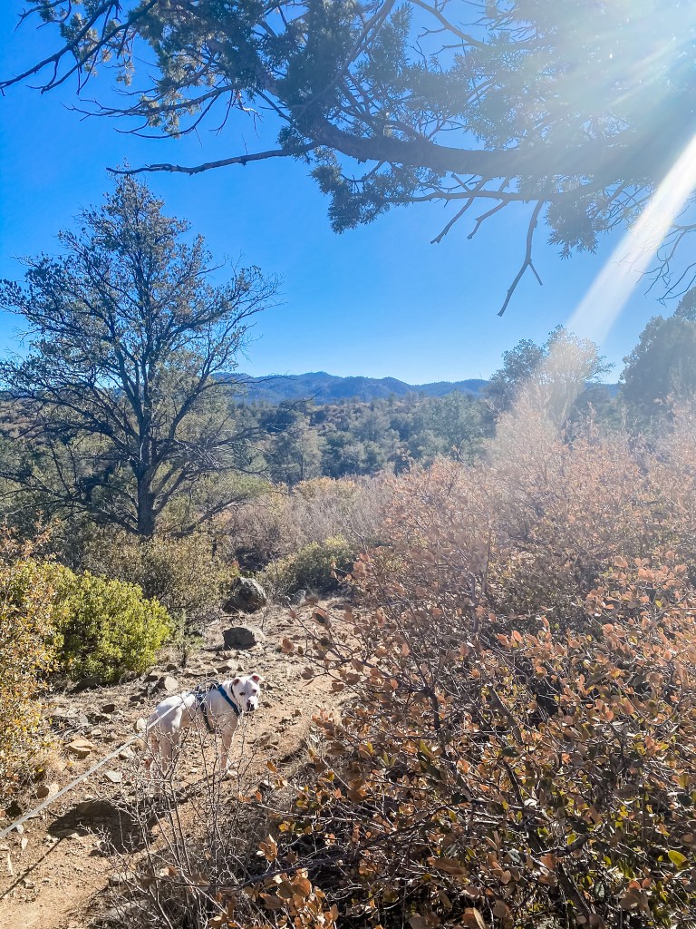
Next up on the hiking location sample platter we were building for ourselves was Prescott. This city is one we had heard about before because one of my cousins often travelled there for baseball growing up, but other than that, we didn’t know too much about it. Prescott is an hour and half from where we were staying, so it was a bit too far to drive for a hike on a standard weeknight. Luckily for our situation, M has an early Friday every other week where he can log off at 1:15PM. On those days where we want to do something during a Friday afternoon and I don’t want to take a vacation day, I can usually still cut out a little early and make up any missed time over the weekend. So that was what we did on this Friday, and we planned two hikes in Prescott to make the drive worthwhile; one for the exercise, and one for the views. Salida Gulch Trail was the trail we used to get our steps in for the day. It wound around a large hill (or small mountain – not actually sure what constitutes one or the other) and even though there was a fair bit of climbing, it was spread out enough that we didn’t even notice it until suddenly you could see for miles. This area is also active grazing land for local ranchers (err… their cattle), and the trail had a half dozen livestock gates on it that you had to be sure to lock up again after you walked through! After doing a couple hikes in Sedona, we were surprised by how different the landscape was just 50mi west. It was all pine forests and scrub brush and gray stone in Prescott. If you had showed us the pictures we took hiking Salida Gulch before we had been there, we wouldn’t have been able to guess that they were from Arizona. We were having fun getting to know so many different parts of this beautiful state though! We gave this trail 4 stars since it did what it was supposed to do, but didn’t go above and beyond our expectations.

Is Dog an angel sent from heaven? Yes.
Constellation Loop
2.4 mi – 236 ft elevation gain – Loop
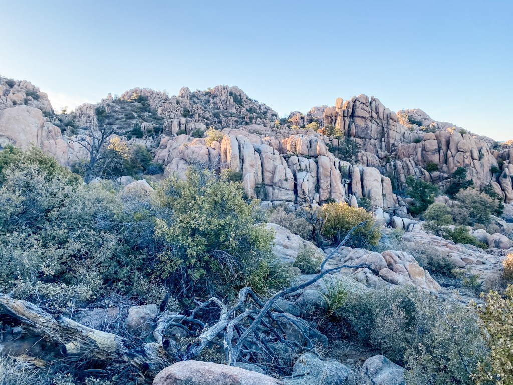
Right after Salida Gulch, we hustled over to Constellation Park which is managed by the city of Prescott. We had already gotten our exercise in for the day, so this trail was strictly for the views, and it delivered! Constellation Park was filled with really cool and bizarre rock formations that you could scramble up, onto, and around. To me, it looked like the fake savannah habitats at the zoo, so I immediately felt like a little meerkat (a neutral feeling) getting to amble around my new exhibit. This is the exact type of park that I could’ve killed a whole day exploring as a kid, and even as an adult, it was pretty cool to have this natural playground at my fingertips. M kept wanting to climb to the top of the farthest rock formations to “see what was on the other side” but we tried to be good stewards of the land and stick to the trail, which here, was marked with painted white dots on the rocks. Dog seemed to enjoy this trail as well, and earned his mountain goat badge here for his ability to confidently climb up and down the rocks, even when there wasn’t much purchase on the stones. This park earned a full 5 stars from us, and we were actually kind of bummed that we didn’t have a picnic dinner to eat on the rocks here!

Petrified Forest National Park
Boy, were we on a national park high coming into Arizona. We wanted to keep that momentum, so we found a nearby (-ish) national park to visit on our first weekend here. It was a bit of a drive, so we knew we wouldn’t be able to do it after work, and our first Saturday was wide open. I’m going to give each national park its own post, so I won’t spoil the surprise here!
Pass Mountain Trail + Cat Peaks Pass
8.69 mi – 963 ft elevation gain – Out & Back + Loop
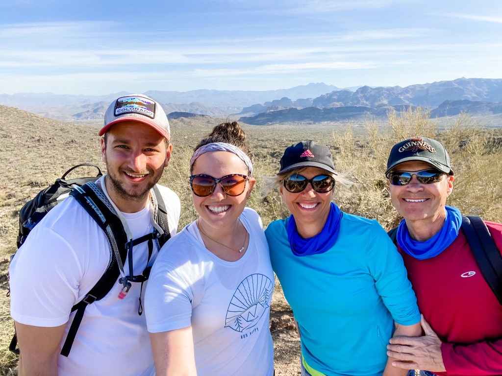
On Sunday we got to meet up with my aunt and uncle who live in the greater Phoenix area – such a treat! They suggested meeting up at Usery Mountain Regional Park in Mesa at 7:30AM to beat the heat. That was a great plan except for the fact that we were staying 2hrs and 20min north of Mesa, so in order to get up, get everything ready for a hike (including Dog and all of his supplies), hit the road, and stop for breakfast as soon as restaurants open up for the day, we were looking at a wake-up call sometime in the 4AM hour. M told me to just take the hint that my relatives didn’t want to see us since no one in their right mind would agree to those terms for a leisurely Sunday morning hike, but I was undeterred. We woke up at 4:30, hit the road at 5:00, stopped for Starbucks along the way, and made it to the park just 10min late. Even with the drive, I’m so glad that my aunt and uncle chose this park for a hike rather than something closer to us, because it is a lot more quintessential AZ in the Phoenix area than it is up north where we were staying. It has the sand and the saguaros (cacti) and everything you think of when you picture the desert, and we hadn’t seen that yet on our trip! We started off along Pass Mountain Trail, which is a 7mi loop around Usery Mountain. We took in the views and caught up and had such a sweet morning! We ended up turning back at around 2.5mi because a.) we were a little worried about how Dog would do on the rockier portion around the back of the trail, and b.) there was another really scenic trail called Cat Peaks that we wanted to get to as well before any of us tapped out from the heat. Cat Peaks had less climbing, but was equally scenic and put you up close and personal with the desert flora. Overall, we loved the park and the company and gave these trails top ratings as well.

Click to see a flossing cactus 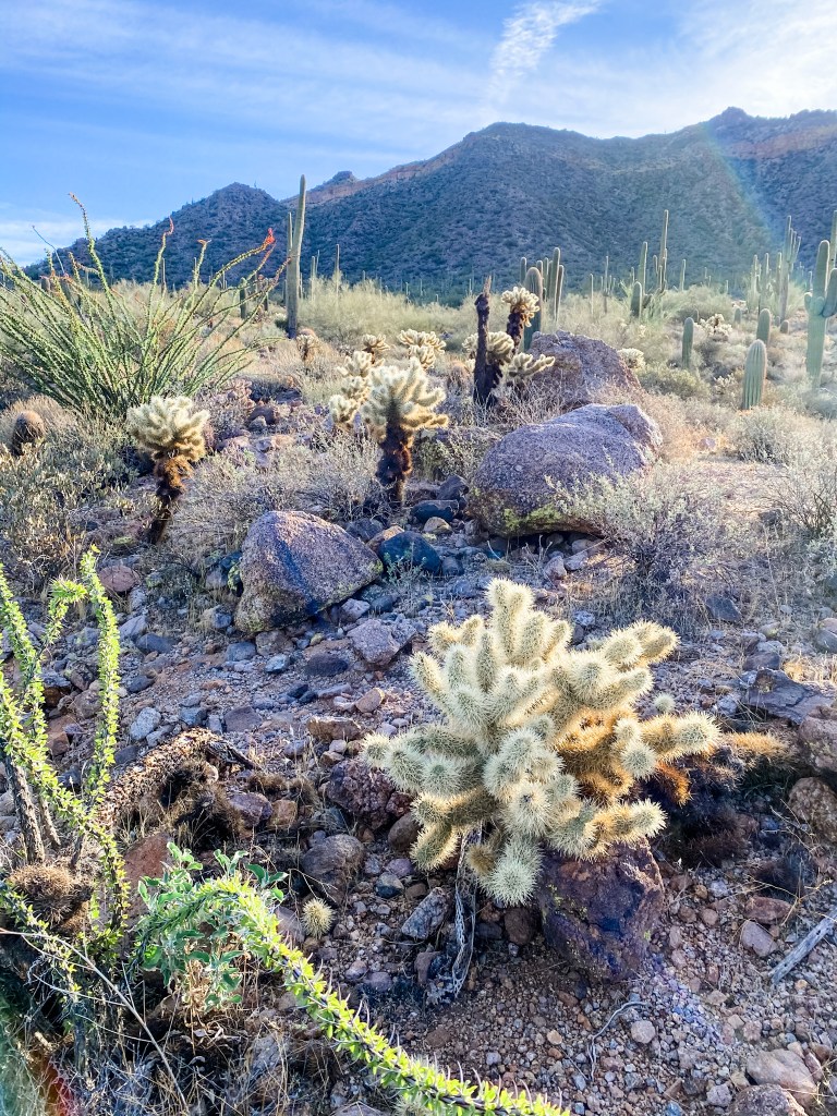


The best hiking squad!
Studs
- We made it to ANOTHER national park! Are we literally unstoppable??
- Dog did not, I repeat, did NOT get stuck with any cactus tines! Good boy, Dog! We were pretty worried that Dog would barrel into the first cactus he saw because he routinely uses his massive head as a wrecking ball/battering ram, and he doesn’t have very much exposure to plants that want to hurt him. To that end we packed a ridiculously comprehensive dog first aid kit and toted it around with us on every hike, but at least here, we didn’t have to use it! There was a close call with a gecko that ran across the trail ahead of us, and Dog reacted with a speed and enthusiasm we were not expecting, but we were able to lock up the leash before he could charge off into the desert. M says Dog’s reaction to geckos is a learned response because I also squeal in delight and try to chase any reptile or amphibian I see in the wild, but I simply cannot believe that is the case here.
- We covered a lot of ground in our first week! This might have actually been the week where we visited the most unique cities/locations, which is pretty impressive for not having much of a plan to work off of. Overall, it felt a bit chaotic, but hopefully before long, we hit our stride with the hikes.
- M is a champ for putting up with me and the walking stick debacle. He is easy-going and generous to me always, and that is why I love him!
Duds
- This week we learned a little something about biting off more than you can chew! I don’t know why we thought that as soon as we hit Arizona we would suddenly have 30hrs in the day to work with. Truly, at the start of this endeavor, we thought we would wake each day at 5AM, work a full 9hrs, make and eat three nutritious meals, hike 7-10mi, watch an episode or two of Shark Tank, play a game, write a blog post, and go to bed in time to get a full 8hrs of shut-eye before it started all over again. HA! We learned you can choose maybe three of those things, and they better be going to work, eating dinner, and getting at least a short hike in. When we are planning an adventure, time literally means nothing to us, and that is the curse that we have to live with. Honestly, I think this is mostly M’s fault because I was much more of a realist before I met him, and also these agendas we come up with are already compromises between my (nearly realistic) plans and M’s (absolutely, laughably, humanly impossible) plans.
- We are terrible dog owners and didn’t bring enough water for Dog while we were in Mesa. Luckily, my uncle is a hero and gave Dog his own water, earning him Dog’s undying loyalty and affection. A fair trade!
- Sprouts
- Despite my best efforts, I was not able to conclude whether or not I saw a mountain lion track on our neighborhood walk. I’ve heard from a lot of people who would know who say that there is a VERY good chance it was a mountain lion, but M has run a moderately successful campaign to gaslight me into thinking it was a dog. The silver lining is that I learned a lot about mountain lions!