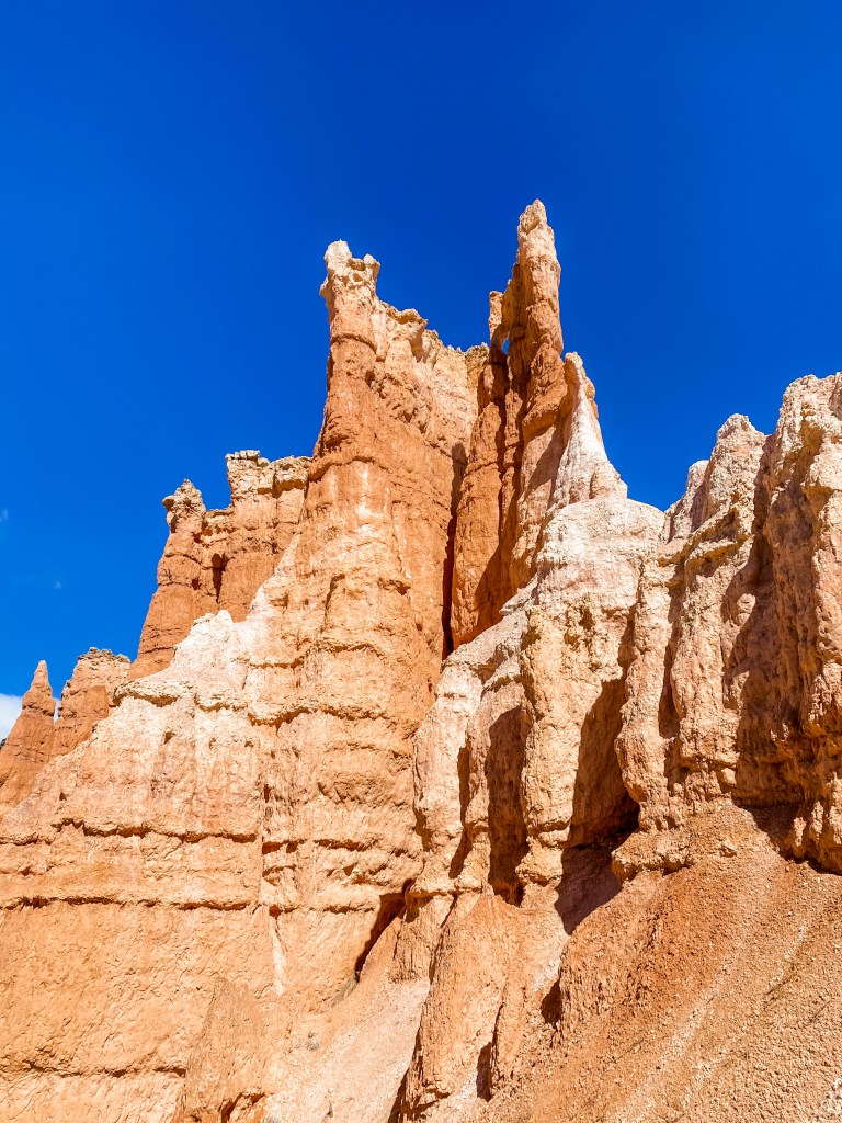
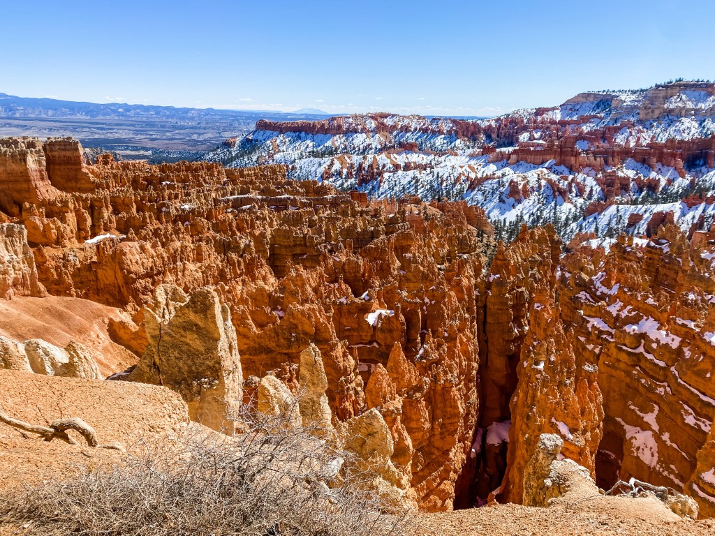
The next stop on our whirlwind adventure through Utah was Bryce Canyon National Park, which would round out our weekend of three national parks in three days. Bryce Canyon was the park that I was personally most excited to see. In the past few years a couple different friends had been to Bryce and shared pictures, and I was very, very intrigued by the hoodoos, the spiky, orange stone monoliths that the park is known for. They did not disappoint.
Although we were more prepared for this park than the others, having sourced recommendations from friends on trails, directions, timing, etc., somehow we were still unprepared for the weather. We had checked the weather in the morning, as one does when getting dressed for a day of outdoor activity, but had failed to take into account the simple fact that our Airbnb was a full two hours and apparently several climate zones away from Bryce (more on that later). On our drive over, we watched in indignation as the thermometer dropped steadily from 52° to 19° and confirmed when we got there that the temperature at the canyon would not get above freezing for the day. Great. Luckily, even an unprepared J is more prepared than the average tourist, and we were able to don our emergency hats and mittens to keep comfortable. Plus, once you were in the canyon, you were pretty well out of the wind, which was nice.
Queen’s Garden and Navajo Loop
The Queen’s Garden and Navajo Loop trails seemed to be the main route through the park. On both the recommendation of a friend and the park ranger that we spoke to at the visitor center, we took the route clockwise. This served two purposes: first, it kept the main payoff of the trail in terms of views at the end rather than the beginning, and second, it allowed a steep, snowy portion of the trail that is partially shaded in the morning a chance to dry out a bit in the sun before we got there.
This hike dropped us into the canyon right away and gave us a chance to get up close and personal with some of the hoodoos. Once we were at the bottom, I felt like an ant on an ant farm, but in the best possible way. It was a giant natural playground! The trail wound around and through the rock formations and the surprisingly lush forest at the bottom. When it was time to climb again, the trail split into two different routes, Wall Street and Two Bridges. We were under strict instructions to take the Wall Street route, but unfortunately, the decision was made for us since Wall Street was closed for the winter. Two Bridges was the portion of the trail that the ranger had been referring to that was covered in ice and snow overnight, and was actively melting during the day. Until that point, the route was pretty easy and uncrowded. Apparently though, most hikers at Bryce that day did not get the memo to go clockwise around the trail, and they were all coming down the Two Bridges trail, which was slick with orange, cakey mud. I am immensely pleased that we were climbing, not descending for that portion, because the traction was minimal and the potential to look like you just ran a Tough Mudder was maximal.
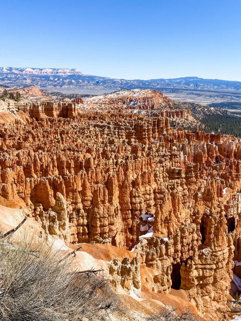
While we did enjoy this trail, we spent most of the hike looking for the iconic view of the “hoodoo forest” that we had seen in our friends’ photos. We didn’t actually find it on this trail, but the payoff at the end was a pretty cool view from the top of Sunset Point. We wish Wall Street had open, because the view from that side of the lookout was stunning!
Ant farm vibes 
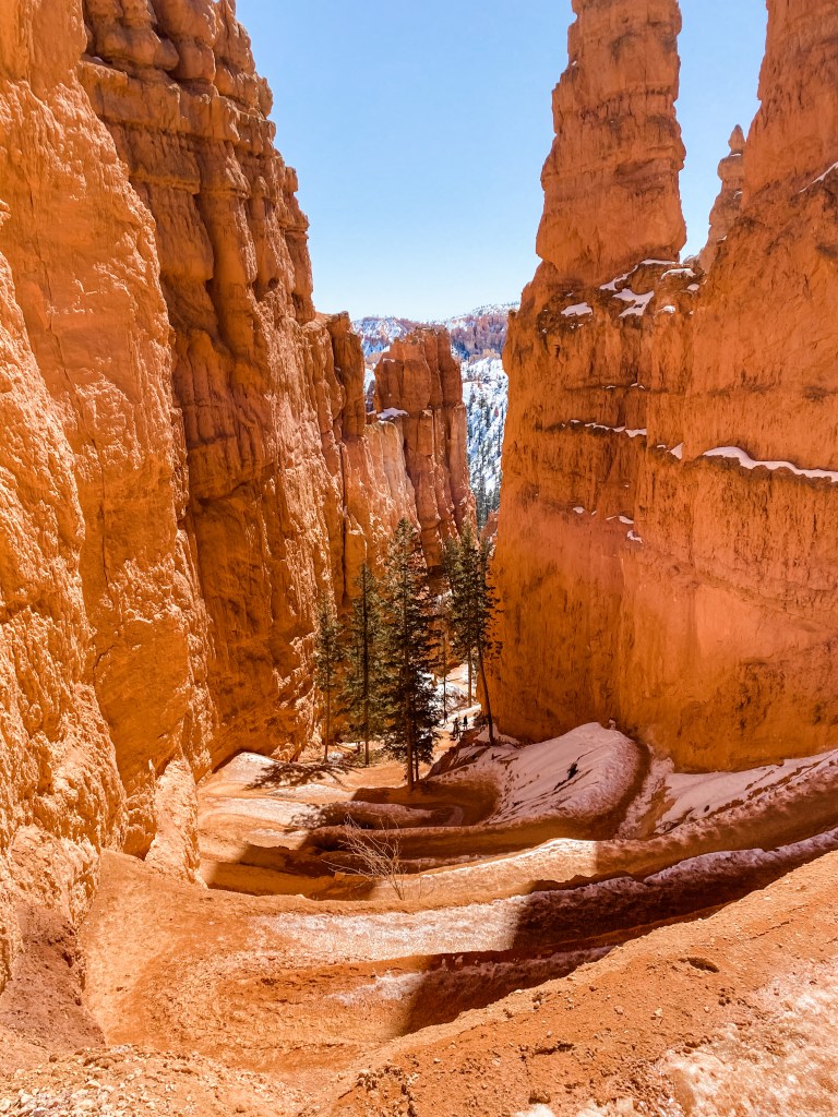
Looking back at the sloppy Two Bridges climb 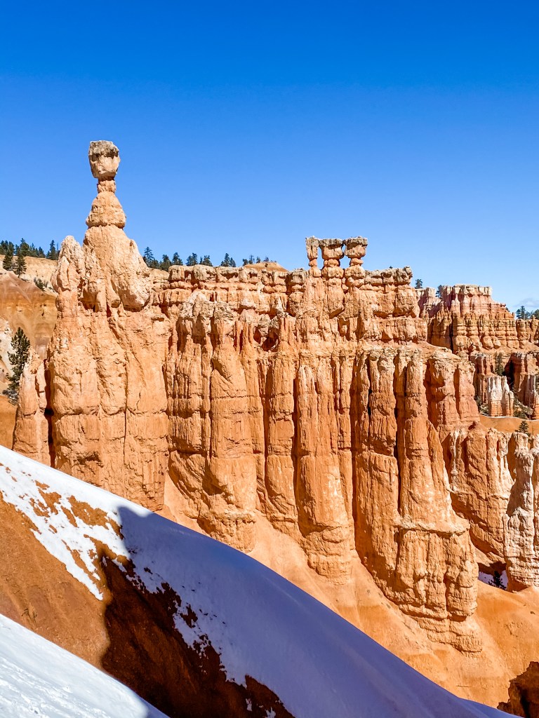
Hoodoos from halfway up the canyon 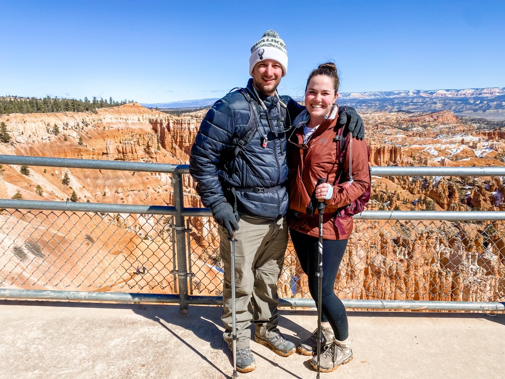
On this trail we also learned about the geology and topology of the region and how the hoodoos formed. Around 50 million years ago, the area that is now Bryce Canyon was a lake and flood plain, so streams would carry particles from surrounding areas of higher elevation and deposit them in the basin. The minerals settled and solidified into rock that was then raised to its current elevation through the collision of a few key tectonic plates. All of this laid the foundation for the hoodoos by creating a fun blocky plateau that was a mixture of a ton of different kinds of rock – limestone, sandstone, and dolostone to name a few. Then came the master sculptor that is erosion. Moisture from rain and snow melt seep into the porous stone and dissolve the calcium carbonate trapped within the rock. The calcium carbonate occurs at different levels in each of the various rock types, accounting for the wacky formations of the hoodoos and the lack of uniformity in the erosion process. Plus, the current elevation of the canyon sees more than 200 nights a year where the temperature is both above and below freezing. When the moisture trapped in the rock freezes, it expands and puts pressure on the stone, weakening it. When it melts, the water gets back to work dissolving the calcium carbonate, and carries the sediment down to the canyon floor. So cool!
Rim Trail to Inspiration Point
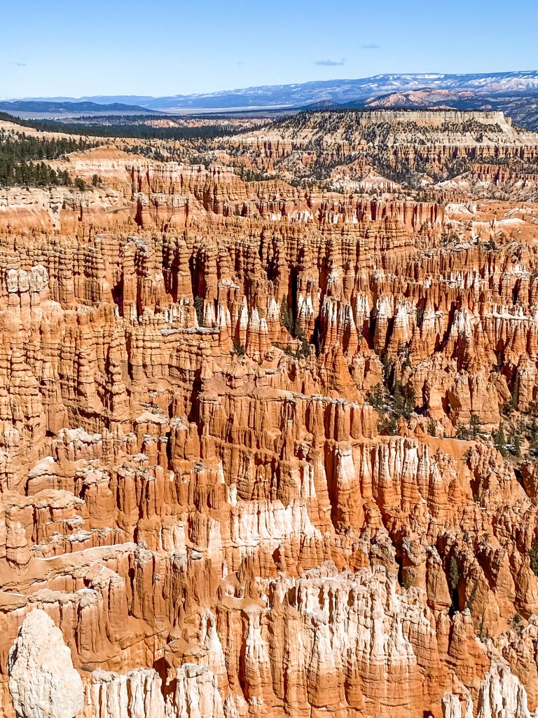
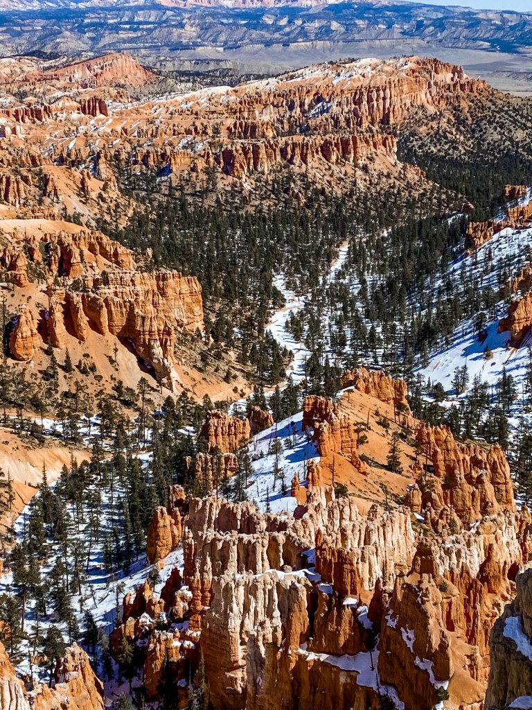
Inspiration Point is the reason you should go to Bryce Canyon. A friend had outlined a route for us that included driving to Inspiration Point, but by the time we finished the Navajo Loop, we were feeling pretty good, and just kept walking along the rim chasing cooler and cooler views. The Rim Trail from Sunset Point to Inspiration Point appeared on the map as 0.7mi, but actually walking it was more like 1.4mi one-way. We’re not quite sure where the disconnect was since there wasn’t much opportunity to get lost just following the rim of the canyon. This trail was definitely less traveled than the other, and the conditions left it snowy and windy, but the constant breathtaking views back into the canyon were more than worth it.
When you get to Inspiration Point there is a main platform, and then two additional lookouts if you are willing/able to climb a bit. We were ready for that climb and went all the way up to the tippy top. This was the slickest part of any of the trails that we did since the packed snow was frozen into an icy ramp at what was effectively a 45° angle. Luckily, we had our Yaktrax and our hiking poles that helped us gain traction on the ice. The view from both of the additional lookouts was beyond amazing, but we couldn’t stay for too long – the wind up there was even crazier than on the rim!
Seeing the hoodoos along this entire trail and at Inspiration Point was the view that we had been looking for since arriving at Bryce Canyon. It was the “hoodoo forest” we had hoped to see from the beginning. To me, all the hoodoos standing at attention and lined up like that looked like the terra-cotta army at the burial site of of China’s first emperor. I’ve never seen the terra-cotta warriors in person, but whatever image I must’ve seen in a National Geographic magazine growing up really stuck with me, because it was all I could think of looking back into the canyon. If this was all we had seen at Bryce Canyon, the trip would’ve been worth it.

Mossy Cave
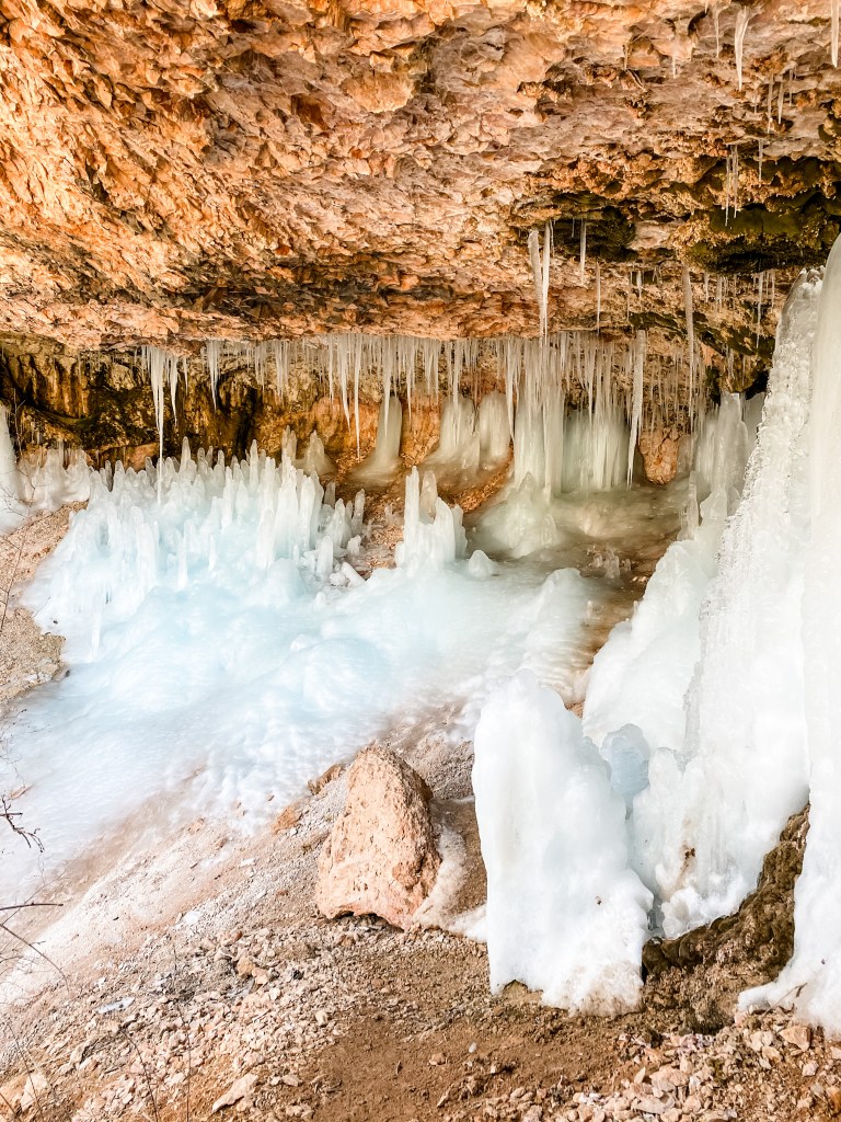
This was a very short bonus trail that we tacked on to the end of our trip through Bryce. It ends at a small drippy waterfall in a little sheltered cave. Depending on the season of your visit, you’ll see either a cave full of icicles or a cave full of spongy moss. Of course, we got the icicles, and it was awesome! A perfect little chaser for our hoodoo bonanza from before. This would be a great trail to bring little kids on since you can splash around in the streams and waterfalls. There are only a few parking spaces at this trailhead though, so avoid peak hours if you can!
Studs
- We stopped and talked to a park ranger on our way into the park. This is definitely one of our parks pro tips! The ranger stationed at the visitor center can make recommendations based on your interests and skill level, tell you the trail and weather conditions, highlight routes on your map, and give you the inside scoop on all the best parts of the park! Our ranger literally drew on our map to mark trail closures and routes, and was the one to clue us into the clockwise game changer. She also told us that Inspiration Point was her favorite view in the park and told us that we would definitely need traction devices if we wanted to get up to the elevated lookouts. Nobody knows the parks better than the rangers, and our experiences are always better for having talked to them beforehand!
- Yaktrax. Yet again our Yaks are on the studs list! These suckers are super light and easy to tote with us and have saved us multiple times on slick trails. We’ve seen other hikers with chains and microspikes and all manner of other traction devices on their boots, but nothing can top our Yaks. Customers for life!
- Our friends were able to let Dog out of the crate before they checked out of the Airbnb, allowing us to take a full day trip to Bryce. Without that we would’ve been pushing it because the park was so far away. Without our friends around, our next best option would have been to board Dog somewhere near Bryce Canyon, which adds a ton of logistical complexity, time, cost, and stress to the trip. It can be nice to travel on your own, but you really can’t put a price on having an extra set of trusted hands in situations like these.
- Our National Parks Pass absolutely did work here. Part of our initial decision not to buy the NP pass was that I had read that it would not be valid for entry into Bryce Canyon. I’m not sure where I read that, but it did not turn out to be remotely true. It has saved us a ton of money in day passes already.
Duds
- Bryce Canyon was way farther away from our Airbnb than we expected. We had heard from a couple people that you could do Bryce Canyon and Zion in one day if you really put your mind to it, so when we booked our Airbnb and it was called “Zion’s Retreat” we really didn’t stop to check how far away Bryce was. We assumed it would be close. As we were driving in though, we passed a sign for Bryce Canyon while we were still hours away from our place. As it turned out, our Airbnb was a good two hours away from the Canyon, and was clear on the other side of Zion, so there was really no easy way to get there. We didn’t map this portion of the trip out very well and ended up having to drive 4hrs round trip to squeeze this park in.
- There was one jerk ahead of us on the Navajo Loop trail who blatantly and continually ignored posted signs and roped off areas. He stepped over every single “Stay on trail” and “This area closed” chain and plaque on the entire trail and was totally shameless about it. Every time we would catch up with him as he was stepping over the barriers back onto the trail and he would say something dumb like “It looks like people climb up here all the time” or “There are a lot of footprints up that way.” As rule followers and lovers of nature, we were appalled. It was really ruining our day and so we were glad to part ways with him at the first turn off. It’s so narcissistic and boorish to act like the regulations don’t apply to you. These areas are roped off for a reason – either they are dangerous, or there is some sort of conservation or restorative effort underway – and ignoring them is the most self-centered, small-minded display of ignorance we have seen on this trip. Every time we think of this prick, it makes our blood boil.
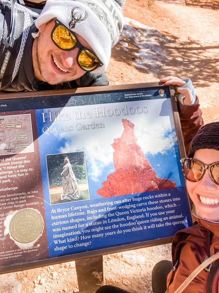
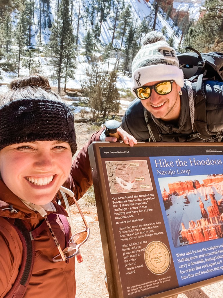
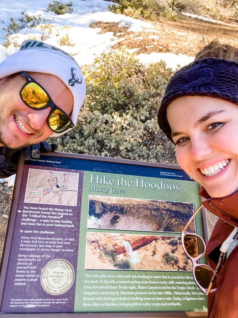
- We didn’t finish the Junior Ranger Medallion Challenge. The park runs a small program for kids that is basically a scavenger hunt for three medallions throughout the park. We read the rules, but didn’t see anything about an upper age limit so we went for it. And, technically, we did complete the challenge, we just never returned to the visitor center to claim our “small reward” and it has been eating us up wondering what we might have won! A keychain? A certificate? A magnet? The world will never know. See photos below for evidence of completion.

Great review and love seeing the pics of Bryce with snow! Having went myself in July, definitely had none of the white powder when I was there 🙂
LikeLike